Suggested citation format:
Ciolek, T. Matthew (ed.). 1999 - present. Georeferenced historical transport/travel/communication routes and nodes - Africa. OWTRAD Dromographic Digital Data Archives (ODDDA). Old World Trade Routes (OWTRAD) Project. Canberra: www.ciolek.com - Asia Pacific Research Online.
www.ciolek.com/OWTRAD/DATA/oddda.html

OWTRAD Dromographic Digital Data Archives
(ODDDA)
Georeferenced historical transport/travel/communication
routes and nodes - Africa

edited by

Dr T. Matthew Ciolek,

Research School of Pacific and Asian Studies,
Australian National University, Canberra ACT 0200, Australia
tmciolek@ciolek.com
http://www.ciolek.com/PEOPLE/ciolek-tm.html

Document created: 7 Jul 1999. Last updated: 29 Oct 2006

This document catalogs and archives data sets about historical transport/travel/communication routes and nodes. These geo- and chrono-referenced data have been constructed as a part of the Old World Trade Routes (OWTRAD) project.

NOTE: Researchers wishing to publish at this address their own data sets
describing communication and transport networks world-wide are warmly invited to contact the site's editor.


|| OWTRAD Home Page || Notation System || Gazetteer || Catalogue of Caravanserais/Khans || Trade Routes' Glossary || Sources and Bibliography || ODDDA Home Page ||
Series 1 - Routes:
|| Africa || Asia & the Middle East || Europe || Timeline ||
Series 2 - Significant Nodes:
|| Old World ||

Google [Search by authors, route, cargo, geography, or time-period]
 
Web ODDDA georeferenced data sets
 

Be sure to check back frequently for updates/corrections and new datasets

Individual OWTRAD data sets (geospatial and historical description of NODES and connecting them travel ROUTES) which are listed below follow exact specifications of the OWTRAD Notation System, a tool for digitization of information extracted from sources containing text and/or graphics.

Please also note that the filenames below (e.g.'tmcILa0600.html', or 'tmcDZm0500.html') observe the following convention:

    Africa

  1. North-West Africa, 500-1800 CE, trade routes 
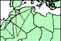
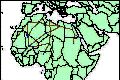
tmcDZm0500.html North-West Africa, 500-1800 CE, trade routes
    [28 routes' segments; Src: Oliver 2000; georeferenced]
  2. Mediterranean countries, 200 CE, trade routes 
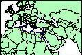
tmcEGm0200.html Mediterranean countries, 200 CE, trade routes
    [45 routes' segments; Src: Stone (ed.) 1989; georeferenced]
  3. North Africa, 1300-1900 CE, pilgrimage routes 
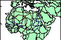
tmcDZm1300a.html North Africa, 1300-1900 CE, pilgrimage routes
    [135 routes' segments; Src: al-Naqar 1972; georeferenced]
  4. North Africa, 1300-1900 CE, trade routes tmcDZm1300b.html North Africa, 1300-1900 CE, trade routes
    [33 routes' segments; Src: al-Naqar 1972; georeferenced]
  5. Morocco, 200-1930 CE, caravan routes 
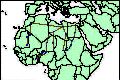
tmcMAm1500.html Morocco, 200-1930 CE, caravan routes
    [20 routes' segments; Src: de Rouvray 2001; georeferenced]
  6. Tanzania, 1700-1890 CE, trade route tmcTZm1700.html Tanzania, 1700-1890 CE, trade route
    [6 routes' segments; Src: United Republic of Tanzania 2006; georeferenced; also available in Google Earth/KML format] [NEWEST DATASET, published Oct 2006]
  7. [further data sets will be published here ...]


Maintainer: Dr T. Matthew Ciolek (tmciolek@ciolek.com)

Copyright (c) 1999 - present by T. Matthew Ciolek. Creative Commons License OWTRAD materials and data sets may be distributed only subject to the terms and conditions set forth in the Creative Commons Attribution-Noncommercial 2.5 License. Please direct comments, questions or requests about this license policy to tmciolek@ciolek.com.