 The World-Wide Web Virtual Library
Edited by:
Dr T.Matthew Ciolek
[Est.: 20 Feb 2004. Last updated: 23 Mar 2005.]

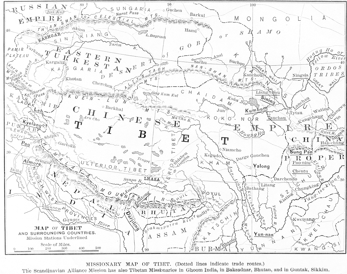
Sourced from: Shaw, F. Becker. 1897. Missionary Map of Tibet (dotted lines indicate trade routes) / The Scandinavian Alliance Mission has also Tibetan Missionaries in Ghoom, India, in Baksadnar, Bhutan, and in Guntak, Sikkim. In: "The Siege of Tibet," The Missionary Review of the World, vol. X (n.s), February 1897, pp.91-95 (The Map is printed opposite p.92). - tmc.
The map was originally published online at http://library.berkeley.edu/EART/maps/tibet.gif by the U. California, Berkeley, USA. Sometime in mid-2003 the image file, formely also labelled by the UC. Berkeley as "library.berkeley.edu_tibet.gif", was taken off that address.
Its valid URL is, at the time of writing, not known.
However, on 23 Mar 2005 Jim Casilio has kindly informed me that a cropped version of the same map has been made available online from http://www.lib.umich.edu/area/sasia/Tibet/Tibetan_collection_web/Tibetan_collection_home.htm - tmc.
Maintainer: Dr T.Matthew Ciolek tmciolek@ciolek.com
Copyright © 2004-present by T.Matthew Ciolek. All rights reserved. This site may be freely linked from other web pages world-wide. Contents may not be republished, altered or plagiarized. The www.ciolek.com editors do not control or endorse the content of third party web sites.
URL http://www.ciolek.com/WWWVLPages/TibPages/tibet-map-1897.html
Internet Archive http://web.archive.org/web/*/www.ciolek.com/WWWVLPages/TibPages/tibet-map-1897.html